


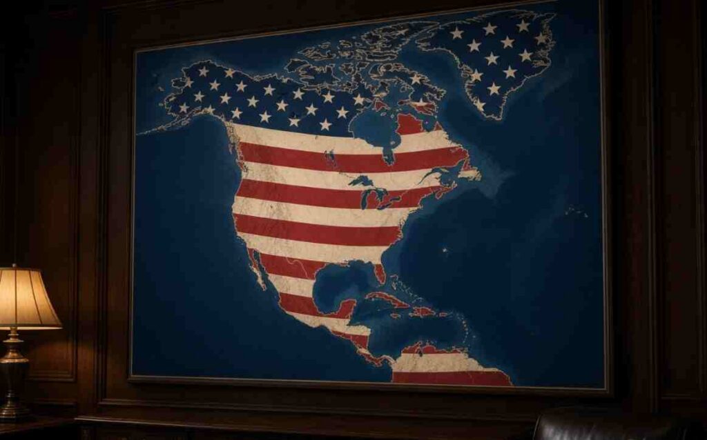
Trump US Expansion Map Post – US President Donald Trump sparked fresh diplomatic chatter and online backlash after sharing an uncaptioned, AI-generated map on Truth Social showing an expanded United States covering nearly all of North America The viral image depicts the American flag superimposed across 23 sovereign nations and territories including Canada, Mexico, Greenland, Cuba, and various Caribbean island nations—without any accompanying text or official explanation from the White House
Trump US Expansion Map Post – Uncaptioned Post Triggers Global Reactions and Political Debates
The geographic scope of the posted map encompasses continental North America, Greenland (an autonomous territory of Denmark), and multiple Caribbean nations including Jamaica, Haiti, and the Bahamas . While foreign policy analysts characterized the post as political theater and classic online provocation rather than an actionable policy document, experts warned that such symbolic gestures risk complicating ongoing trade, security, and diplomatic dialogues with regional allies
Trump US Expansion Map Post – Pattern of Cartographic Posts and Geographic Renaming Directives
The controversial image follows a series of similar social media posts and administrative actions by Trump aimed at redefining regional geographic designations Just days prior, Trump posted a graphic proposing to rename the state of New Mexico as “New America,” drawing immediate condemnation from local state leaders . The administration previously issued directives renaming the Gulf of Mexico as the “Gulf of America” and directing federal agencies to label Lake Ontario as “Lake America” amid ongoing economic disputes with Canada
Trump US Expansion Map Post – Allies and Local Officials Push Back Against Territorial Imagery
New Mexico Governor Michelle Lujan Grisham and state lawmakers firmly rejected the social media posts, emphasizing that state identities and sovereign borders are not subject to executive whim Abroad, diplomatic observers noted that while allies do not anticipate immediate territorial moves, repetitive cartographic posts create unnecessary friction, particularly as Washington pursues high-stakes trade negotiations with Ottawa, Mexico City, and European partners